Page 26 - Surveyor 54.3 and 4
P. 26

PEER REVIEW
        PEER REVIEW
        The Malaysian Surveyor


                                                                                for simple visualisation and fully
                                                                                automated procedures can be
                                                                                applied. The use of equipment and
                                                                                software is necessary to gain some
                                                                                of the knowledge. This research uses
                                                                                a total station which the accuracy is
                                                                                about ±2mm + 2 ppm and a digital
                                                                                camera with a high-resolution image
                                                                                capturing.


                                                                                2. Material and
                                                                                Methods
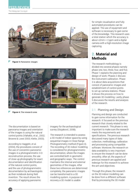
            Figure 3: Panoramic images
                                                                                The research methodology is
                                                                                divided into several phases namely
                                                                                phase one, two, three, four, and five.
                                                                                Phase 1 explains the planning and
                                                                                design of work. Phases 2 discuss
                                                                                the instrument calibration. Phase
                                                                                3 is about data acquisitions that
                                                                                consist of panoramic images and
                                                                                establishment of control points
                                                                                to set up camera stations. Phase
                                                                                4 shows the process on how to
                                                                                generate 3D modelling. Lastly, phase
                                                                                5 discusses the results and analysis
                                                                                of the research.


                                                                                2.1.  Planning and Design
            Figure 4: The research area
                                                                                Planning and design are conducted
                                                                                to gain some information for the
                                                                                research. It focused on the previous
                                                                                research that closely related to the
        The documentation is based on       imagery for the archaeological      current research. This phase is very
        panorama images and orientation     survey (Stojaković, 2008).          important to make sure the research
        of the images is using the natural                                      meets the requirements and
        control points (Vlahakis, et al., 2002;   The research is intended to assess   specifications. The previous research
        Browne & Lowe 2003; Klette, 2003).  a 3D model of indoor space by using   discussed many types of data
                                            sequential images in Close Range    collection, methodology, calibration
        According to Haggrén, et al.        Photogrammetry method (Figure 4).   and processing using compatible
        (2004), the procedures consist of   The recording of 3D indoor modelling   software. Moreover, the research on
        the use of concentric panoramic     is considered for photogrammetric   data availability is very important
        images in a photogrammetric 3-D     documentation, where the images     to ensure the research can be done
        reconstruction process, the use     are controlled both in geometric    smoothly. After all, the aspects of
        of close up photography for exact   and geographic ways. The control    previous research are applied and
        documentation and identification    maintains the internal and external   redesign for this research to achieve
        of the natural control points,      geometries of the images. After     the aim and objectives.
        and the use of photogrammetric      these two references are determined
        documentation by archaeologists     completely, the panoramic images    Through this phase, the research
        as their notebook during field      can be transformed to a 3D          on the 3D indoor modelling can
        invention. The result shows the     modelling system. A purpose of      be done from a different software
        accuracy of applying panoramic      recovery a 3D model is usable       that by processing the 3D model


         26
   21   22   23   24   25   26   27   28   29   30   31